|
|
| PRIMA PAGINA / Storia / Foto / Renoir / Madonna / San Rocco / Toronto / Australia / Ricordi / Proverbi / Guestbook |
| HOME / History / Photos / Renoir / Madonna / Saint Rocco / Toronto / Australia / Memory Lane / Proverbs / Guestbook |
|
|
PICTURES OF CAPISTRANO / FOTO DI CAPISTRANO (From Coccari to the Church / Da Coccari alla chiesa) (Foto di Michele Caputo / Photos by Mike Caputo)
This serie of pictures will take you on a trip from the northern side of Capistrano to the middle of town.
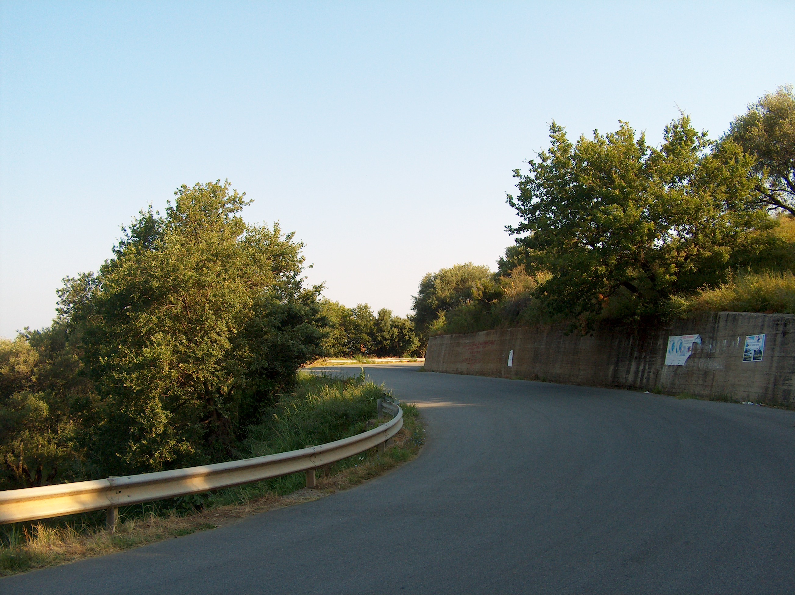
If you arrive in Capistrano from the north side, you will travel through this winding and picturesque road. The area is luscious green, because much of it is covered with centenery olive trees. Driving on this road is a lot of fun...but be very careful- - the curves can be a real challenge.
The mountain on the side of which much of the town was built is found behind this hill. The white spot in the middle of the picture is the location where a massive statue of Jesus with outstreched arms is located. The pictures in this collection which were taken from above, were taken from that location. The light brown area on the hill is a small kiwi plantation.
These are the first houses you will see, as you arrive in Capistrano from Monterosso, the nearby town. after this area you will reach, "Il Zufone," one of the better known area of town.
"Il zufone" or "La batia" area, seen from the mountain. That is the area where the town supposedly began around the year 800 A.D. New houses are being built, which are multi-level and very spacious, unlike the houses in the older part of town. Most of the trees you see are olive trees.
"Il Zufone" area, near the Batia fountain, early in the morning. These were government homes, built around the fifties for poorer families. The tenants originally paid very small amounts to live there; the old tenants are now essentially the owners, even though "theoretically" the government still owns them.
"La Batia" fountain. Found on the north side of town, arriving from Monterosso. This is the area where, apparently, the town began. The name "Batia" means "monastery." The town began when some monks arrived from Sicily, around the year 800 A.D. to escape the Arab invasion. A monastery was built and people built their homes and farmed around it. Over time, the small nucleus grew to become today's Capistrano. Please note that the ancient people of Capistrano spoke Greek, up to 400 or so years ago. In fact, Greek words are still used in the dialect today and some locations have Greek names.
From the "Zufone" area of town, looking at the side of the mountain much of the town is built on. As you can see, the climate is mild enough to allow the growth of palm trees and other exotic plants.
Small piazzetta in the "Zufone" area of the north side of town. On the circular structure rests a very old cannon, probably from WW1. From this area, one can see the centre of town (Il Bivio) quite clearly.
The red building is the electrical power station.
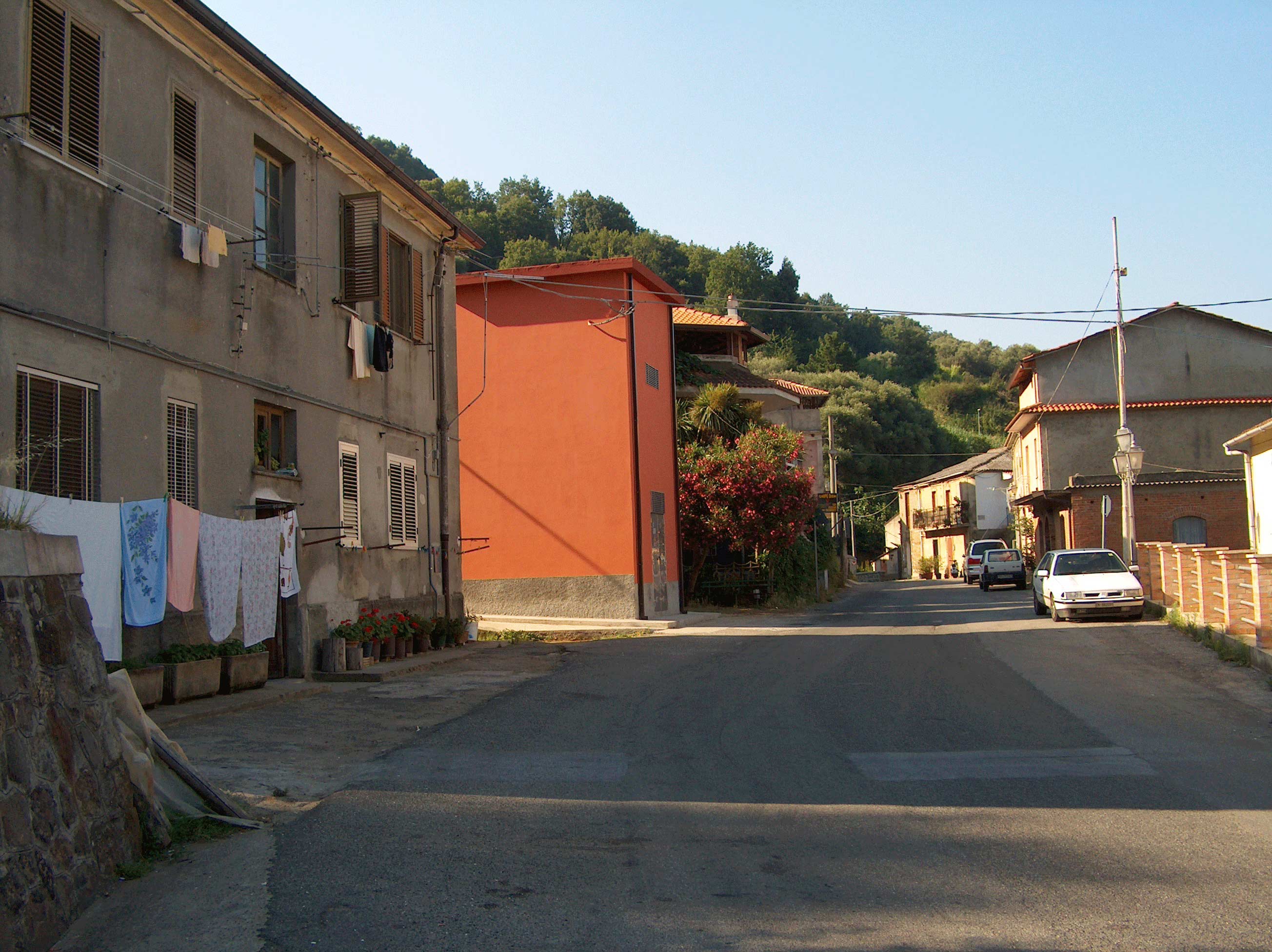
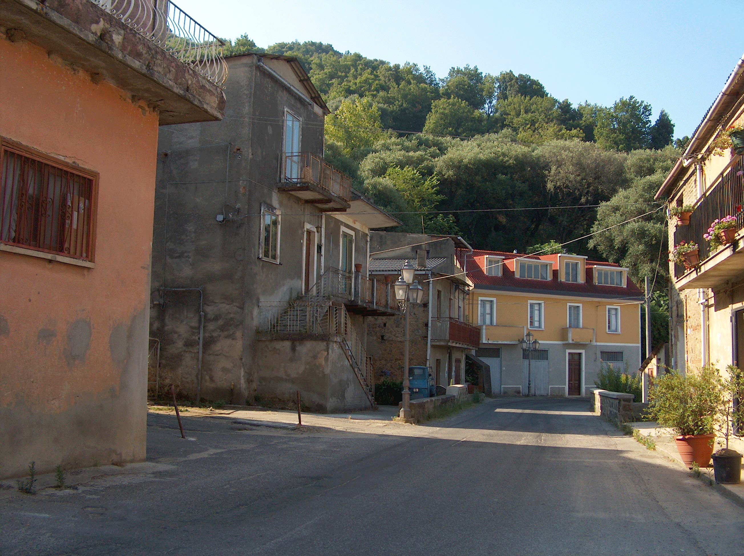
Leaving the Batia / Zufone area
Approaching the Maestro Fera home.
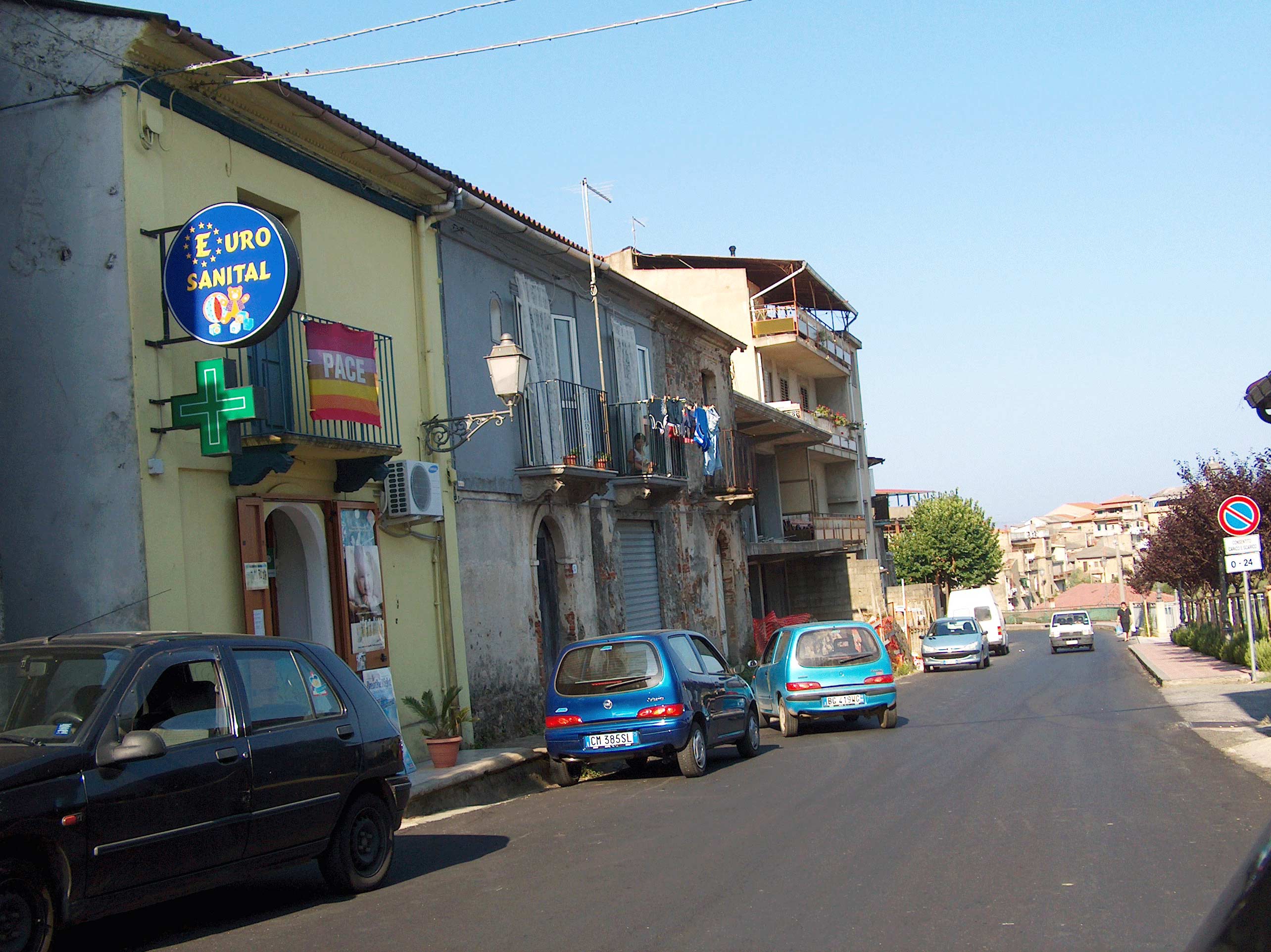
The pharmacy, nearing the new piazzetta.
North of four corners. This lovely square rests on "pillars," as the area under it is a steep valley. Beside being a place to gather, it is also home to the weekly "mercato" (Open air market). In the distance, behind the hills, one can see the Mediterranean Sea. The sunsets one can watch from this piazza are stunning.
The monument to "Padre Pio," a well known Italian Catholic saint. The town's people are very devout Catholics, as their monuments indicate. This statue is found right across the new piazza.
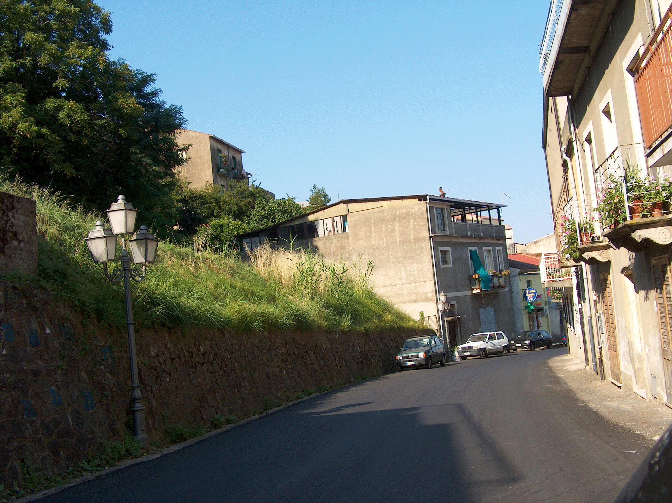
This is the true centre of town, where the two major streets intersect. We refer to it as "Il Bivio", (Four corners). This is where most of the action takes place. In the evening, men gather in this location to talk about sport, politics or to simply joke around, as our townspeople love to do. My family's clothing store and barber shop were located in this area, up to the 1970's. The big green house on the left is built on pillars. It is the house of one of the town's former mayors, Antonio Pasceri. As a child, I used to live on the first floor of the orange house on the left.
From "Il Bivio" (Four corners), looking toward Piazza Renoir.
From Piazza Renoir, looking east toward the mountain. This street leads to "Il Bivio" (Four corners). The yellow building on the left is the church. The house next to the white house on the right is the place where in the olden days most of us went to dream. It was the town's movie theatre. Please keep in mind that these buildings are hundreds of years old.
The main church was completed in 1760. It was built on the same location as an earlier church which was probably built in the 1500's. There is written documentation that a church existed in this location in 1630. The original church was destroyed by an earthquake in 1659. It was rebuilt and was again detroyed by another earthquake, in 1783. It was rebuilt once again from 1794-1798 in a Late Baroque style. It is said to contain a fresco painted by Renoir, which he painted while being hosted by the local priest. Renoir's visit to Calabria was documented by his son in his father's biography.
|
|
Photos List /
Lista
Foto
|
|||